 Javascript debugger
Web page editor
Javascript debugger
Web page editor
45. About Satellite Photos
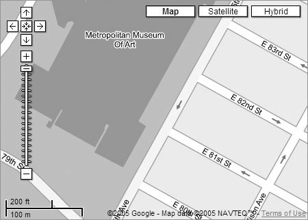
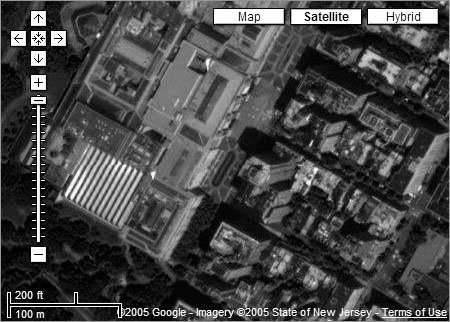
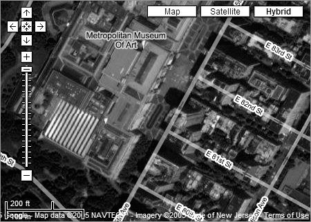
One of the more amazing features of Google Local is its capability to show you actual close-up satellite photos of anywhere in the United States and of many places in the world. To display a satellite photo of a particular area, first display a map location as you would normally. Then click the Satellite button to see a satellite photo of the location at the same zoom percentage as the original map. You can zoom in and out and navigate with satellite photos in the same way as you can with normal maps. Note that not all locations have satellite maps, and in some locations, the satellite maps are low-resolution or cannot be displayed at the zoom level in which your original map is currently displayed. Try zooming out several steps to determine whether a satellite map can be found for that area. (For more information about satellite photos, see Chapter 11, "Discovering the World with Google Earth.") You can also view a hybrid map in which there is a satellite photo with the local street names superimposed over it. The nearby figures show you a map of New York City's Fifth Avenue and Metropolitan Museum of Art, a satellite map of the same location, and finally, a hybrid map of the same location. A Google map of New York's Fifth Avenue and the Metropolitan Museum of Art.
A satellite photo of New York's Fifth Avenue and the Metropolitan Museum of Art.
A hybrid map of New York's Fifth Avenue and the Metropolitan Museum of Art.
|
Javascript debugger
Web page editor